Indian agriculture is undergoing a remarkable technological transformation. For generations, farming in India has depended on traditional knowledge, seasonal patterns, manual labour, and the experience of farmers. While these practices remain valuable, modern challenges are creating a strong need for more efficient and precise methods of farming.
Unpredictable weather, water scarcity, rising input costs, labour shortages, crop diseases, and the need to produce more food from limited resources are encouraging farmers to explore new technologies. Among the most promising innovations are agricultural drones.
Drones, also known as Unmanned Aerial Vehicles (UAVs), are no longer limited to photography, surveying, or defence applications. They are increasingly becoming useful tools in agriculture. Equipped with cameras, sensors, GPS technology, and specialised spraying systems, drones can provide farmers with a bird’s-eye view of their fields and help them monitor crops with remarkable efficiency.
From assessing crop health to supporting precision spraying, drones are gradually changing how Indian farmers observe, manage, and protect their crops.
What Are Agricultural Drones?
An agricultural drone is an unmanned flying device designed to perform or support farming-related activities. Depending on its purpose, a drone may carry a high-resolution camera, multispectral sensor, thermal camera, mapping equipment, or a tank and spraying mechanism.
A conventional field inspection requires farmers or agricultural workers to physically walk through a field. This can be time-consuming, particularly when farms are large or crops are densely planted. A drone can fly over the field and collect images and information within a relatively short period.
The collected data can then be analysed to identify variations in crop growth, moisture conditions, pest activity, disease symptoms, or other areas requiring attention.
This is the foundation of precision agriculture—giving different parts of a field the attention they actually need instead of treating the entire farm in exactly the same way.
Seeing the Farm from Above
One of the biggest advantages of drones is their ability to provide an aerial perspective.
From the ground, a farmer may see healthy-looking crops across most of a field. However, an aerial image can reveal patches where plants are growing differently. Such variations may be associated with water stress, nutrient problems, disease, pest activity, soil differences, or drainage issues.
With repeated drone flights, farmers can also compare images over time. This creates a visual record of crop development and allows potential problems to be noticed earlier.
For Indian farmers, this can be especially valuable where fields may be divided into smaller plots with different soil and irrigation conditions.
Crop Health Monitoring
Crop health monitoring is one of the most important applications of agricultural drones.
Advanced drones can carry specialised cameras capable of capturing information beyond what the human eye can see. Multispectral imagery, for example, can help identify differences in vegetation and plant condition.
The information collected by drones can be processed into maps showing areas of stronger or weaker crop growth. Farmers and agricultural experts can then investigate these areas on the ground.
Early identification of crop stress can give farmers more time to respond. Instead of discovering a problem only after visible damage becomes widespread, they may be able to identify unusual patterns at an earlier stage.
This does not mean that a drone can independently diagnose every agricultural problem. Ground inspection and expert advice remain important. Rather, drones serve as a powerful early-warning and monitoring system.
Drones for Precision Spraying
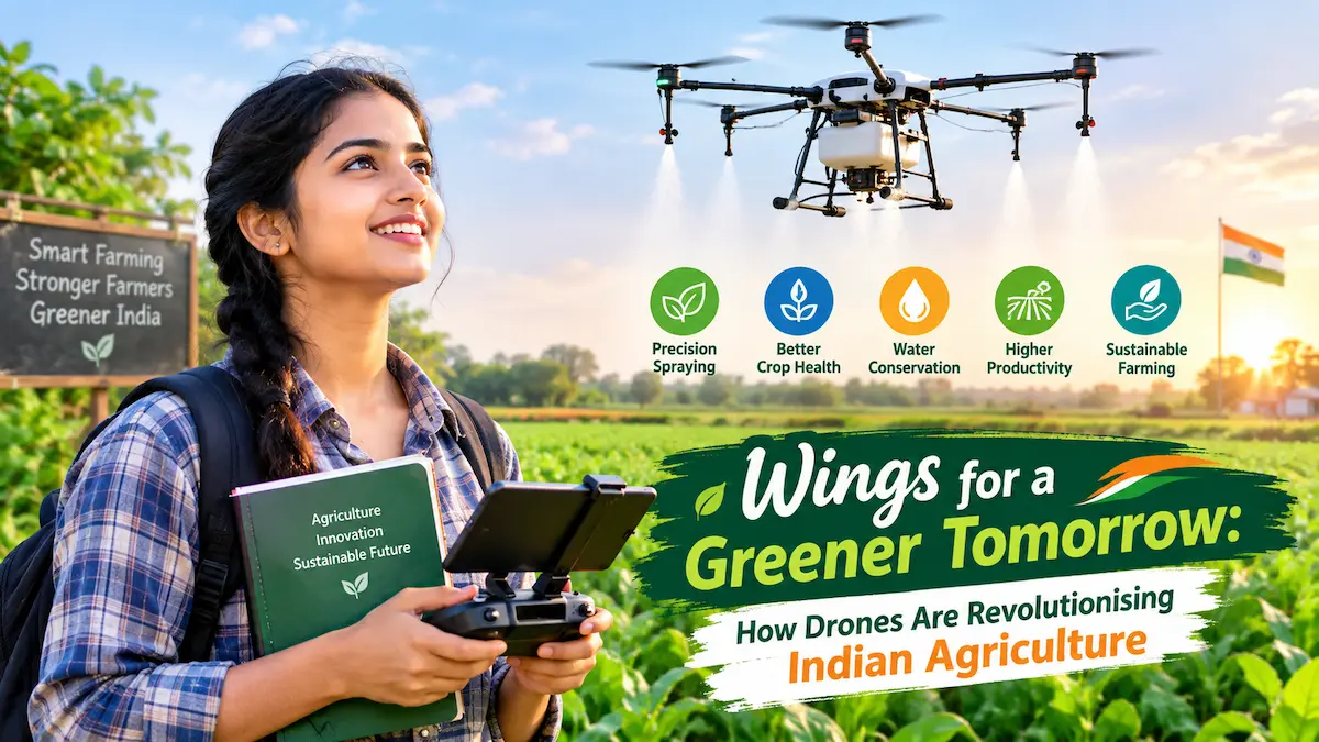
Drone-based spraying is another area attracting significant attention in India.
Traditional spraying methods can require workers to carry equipment through fields. In certain crops and conditions, this can be physically demanding and time-consuming. Spraying from the air can potentially cover difficult-to-reach areas while reducing the need for workers to walk through standing crops.
Drones can be programmed to follow planned flight paths and apply agricultural inputs over designated areas.
However, responsible use is essential. The type and quantity of any agricultural chemical must follow the product label, applicable regulations, and professional agricultural guidance. Weather conditions such as wind also matter because spray drift can affect nearby people, crops, water bodies, and the environment.
Therefore, drone spraying should be considered a precision application technology, not simply a faster way to spray an entire field.
Saving Water Through Better Monitoring
Water management is a major concern for Indian agriculture. Many regions face groundwater stress, irregular rainfall, or competition for available water.
Drones can contribute to smarter water management by helping farmers identify variations in crop condition and field moisture. Thermal or specialised imaging can provide additional information that may help identify areas experiencing water stress.
When drone observations are combined with soil-moisture sensors, weather information, and irrigation records, farmers can develop a better understanding of where water may be required.
This supports the broader goal of precision irrigation—providing water where it is needed rather than applying the same amount everywhere.
Drones therefore have the potential to complement technologies such as drip irrigation, automated irrigation systems, and soil sensors.
Detecting Pests and Diseases
Pests and diseases can cause substantial agricultural losses if they are not identified in time. Walking through every section of a large farm regularly can be difficult.
Drone imagery can help farmers survey large areas quickly and identify unusual patches of vegetation. Changes in plant colour, growth, or canopy appearance may indicate areas that deserve closer examination.
Once a suspicious area is identified, farmers or agricultural professionals can inspect it from the ground and determine the appropriate response.
This approach can help move farming from a reactive model to a more preventive model. Instead of waiting until an entire field shows visible damage, farmers can monitor changes and investigate potential problems earlier.
Drones and Fertilizer Management
Fertilizer is an important agricultural input, but applying more fertilizer does not necessarily mean achieving better crop growth. Excessive or poorly targeted application can increase costs and may contribute to environmental problems.
Drone-generated crop maps can help identify differences in crop growth across a field. When combined with soil-test results and agronomic recommendations, this information can support more targeted nutrient management.
The future of precision agriculture may increasingly involve combining drone imagery with soil data, weather information, crop history, and AI-powered analysis.
Such integration could allow farmers to understand not only where a crop is struggling but also why it may be struggling.
Supporting Farmers During Crop Surveys
Agricultural surveys can be challenging when large areas need to be inspected quickly.
Drones can cover farmland from the air and produce high-resolution images that can be stored and analysed later. This can support crop assessment, damage evaluation, farm mapping, and documentation.
Following events such as heavy rainfall, storms, or other extreme weather, aerial images may help identify affected areas more efficiently than manual inspection alone.
Drones can also assist agricultural institutions, researchers, insurance-related assessments, and government programmes when appropriate procedures and permissions are followed.
Drones and Small Farmers
India has a large number of small and marginal farmers. For this reason, the success of agricultural drone technology will depend not only on whether drones work technically but also on whether farmers can access their benefits affordably.
A farmer does not necessarily need to purchase a drone personally.
One promising approach is the service-based model, in which trained drone operators or agricultural service providers offer drone services to farmers for a fee. Farmer groups, cooperatives, and organised agricultural communities can also potentially share access to such services.
This model can reduce the financial burden of purchasing, maintaining, charging, updating, and operating specialised equipment.
The Role of Government Initiatives
The Indian government has recognised the potential of drone technology in agriculture and has introduced initiatives and policy measures aimed at encouraging its use.
Programmes and schemes have supported drone demonstrations, training, access to agricultural drone services, and technology adoption in different contexts. The exact eligibility, financial assistance, and operating requirements can vary by scheme and over time.
The Kisan Drone concept has also received attention as part of India’s broader push toward technology-enabled agriculture.
Such initiatives are important because technology adoption is easier when farmers have access to training, financing, demonstrations, and reliable technical support.
Challenges in Drone-Based Farming
Despite their potential, agricultural drones face several challenges.
The first is cost. Professional agricultural drones, sensors, batteries, software, and maintenance can require significant investment.
The second challenge is technical expertise. Operating a drone safely and effectively requires training. Data collected by advanced sensors may also require specialised software and knowledge for interpretation.
Regulatory compliance is another important consideration. Drone operations in India are governed by aviation rules and digital systems, and operators must follow applicable requirements concerning registration, permissions, airspace, safety, and operations.
Weather can also affect drone performance. Strong winds, rain, and poor visibility may make flying difficult or unsafe.
Battery capacity is another practical limitation. Large farms may require multiple flights and battery management to cover extensive areas.
Finally, collecting images is only the first step. Useful agricultural decisions require accurate interpretation of the data. Without proper analysis and field verification, aerial imagery may not provide a complete picture of what is happening in the soil or crop.
The Future: Drones + AI + IoT
The real transformation may occur when drones are connected with other agricultural technologies.
Imagine a farm where soil sensors continuously monitor moisture, a weather station records local conditions, a drone periodically scans crop health, and an AI system analyses all the information together.
Such a system could identify a particular area where crop growth is declining, compare the information with soil moisture and weather conditions, and alert the farmer to inspect the area.
This combination of drones, Artificial Intelligence, IoT, satellite imagery, GPS, and farm-management software could create a highly connected agricultural ecosystem.
Drones could become the “eyes in the sky,” while sensors provide information from the soil and AI helps convert the collected data into useful insights.
Creating More Sustainable Agriculture
The ultimate value of agricultural drones should not be measured simply by how advanced the technology looks. Their real value lies in whether they help farmers use resources more responsibly.
If drones enable more precise monitoring, targeted spraying, better crop assessment, and timely intervention, they can contribute to reduced wastage of water, fertilizers, and crop-protection products.
This can support the larger goal of sustainable agriculture, in which productivity and environmental responsibility are pursued together.
Conclusion
Agricultural drones are changing the Indian farming landscape by giving farmers a new perspective on their fields. What once required hours of walking and manual observation can increasingly be supported by aerial imaging, digital mapping, sensors, and precision technologies.
From monitoring crop health and identifying potential pest or disease problems to supporting precision spraying, water management, and crop surveys, drones offer numerous possibilities.
Yet drones should not be viewed as a replacement for farmers. They are tools that can strengthen the farmer’s ability to observe, understand, and manage the land. The best results will come when technology works alongside traditional agricultural knowledge, scientific expertise, and practical experience.
For India, where agriculture supports millions of livelihoods and where efficient use of natural resources is increasingly important, this technological shift could be significant.
The future Indian farm may look very different from the farms of the past. Instead of relying only on what can be seen from the ground, farmers will increasingly have access to information from above, beneath the soil, and from digital platforms.
The drone may fly above the field, but its greatest contribution is helping the farmer see what the field is trying to say.
As drone technology becomes more accessible, better regulated, and more closely integrated with AI and precision farming, it could become an important part of India’s journey toward smarter, more efficient, and more sustainable agriculture.